Now and Then - Cape Town
First mentioned by Portuguese explorer Bartolomeu Dias in 1486 who was the first European to reach the area. He named it "Cape of Storms" (Cabo das Tormentas).
It was later renamed by John II of Portugal as "Cape of Good Hope" (Cabo da Boa Esperança) because of the great optimism engendered by the opening of a sea route to India and the East.
Vasco da Gama recorded a sighting of the Cape of Good Hope in 1497. In 1652, Jan van Riebeeck and other employees of the Dutch East India Company were sent to the Cape to establish a way-station for ships travelling to the Dutch East Indies, and the Fort de Goede Hoop (later replaced by the Castle of Good Hope).
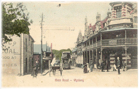
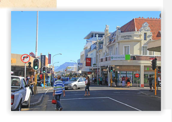
Main Road, Wynberg In 1683 land belonging to Maxine Hall, whose farms along the Liesbeek River supplied the Dutch East India Company, was sold to Herman Weeckens. The farm was named De Oude Wijnbergh (Old Wine Mountain). The Cape's rough seas in the winter months led to a formal winter anchorage in 1743 where ships would dock at Simons' Baai (present day Simon's Town). A wagon route linking Cape Town to Simon's Town went over the hill adjacent to De Oude Wjinbergh estate.
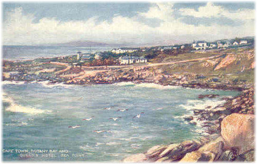
Queens Hotel, Botany Bay, Sea Point
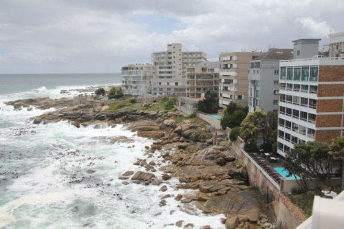
Bantry Bay is a suburb of Cape Town situated on the slopes of Lion's Head and overlooking a rocky coastline. Its neighbouring suburbs are Sea Point and Clifton. It was originally called Botany Bay after a botanical garden that was planted here for the cultivation of medicinal herbs. The name was changed during World War I
Bantry Bay is a suburb of Cape Town situated on the slopes of Lion's Head and overlooking a rocky coastline. Its neighbouring suburbs are Sea Point and Clifton. It was originally called Botany Bay after a botanical garden that was planted here for the cultivation of medicinal herbs. The name was changed during World War I
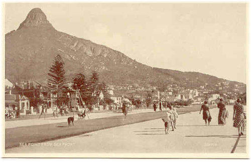
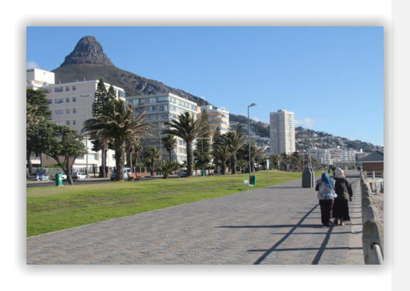
Seapoint and Lions Head
Sea Point got its name in 1776 when one of the commanders serving under Captain Cook, Sam Wallis, encamped his men in the area to avoid a smallpox epidemic in Cape Town at the time. With the 1862 opening of the Sea Point tramline, the area became Cape Town's first "commuter suburb"
Lions Head. In the 17th century the peak was known as Leeuwen Kop (Lion's Head) by the Dutch, and Signal Hill was known as Leeuwen Staart (Lion's Tail), as the shape resembles a crouching lion or a sphinx. The English in the 17th Century called the peak Sugar Loaf.
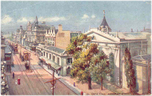
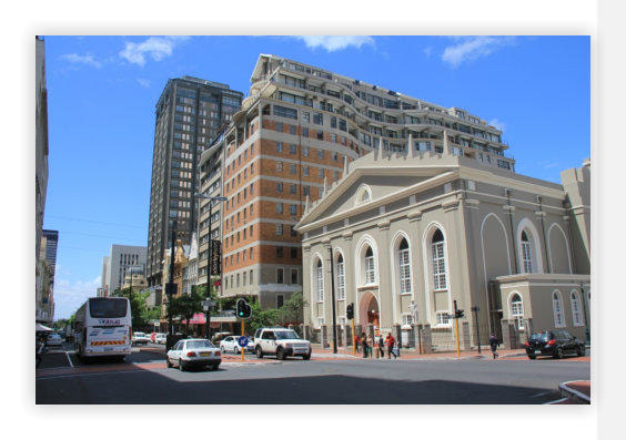
Adderley Street
The main street thought Cape Town’s CBD. The street was originally named Heerengracht, after the canal ("gracht") which ran down its centre, and which had its origins in the rivers from Table Mountain. At the time the street was more of a wide walkway beside the canal, which was crossed by various stone bridges. It was renamed it Adderley Street in 1850, to honour British Parliamentarian Charles Bowyer Adderley (elevated to the peerage as Baron Norton in 1878) who fought successfully against the plan for the British government to make Cape Town into another penal colony
The main street thought Cape Town’s CBD. The street was originally named Heerengracht, after the canal ("gracht") which ran down its centre, and which had its origins in the rivers from Table Mountain. At the time the street was more of a wide walkway beside the canal, which was crossed by various stone bridges. It was renamed it Adderley Street in 1850, to honour British Parliamentarian Charles Bowyer Adderley (elevated to the peerage as Baron Norton in 1878) who fought successfully against the plan for the British government to make Cape Town into another penal colony
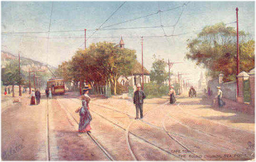
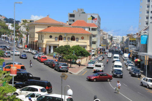
Round Church, Sea Point
Saul Solomon, founder of the Cape Argus and MP for Cape Town, resided in Sea Point until the early 1880s and had much influence on the area’s development. St John’s Church one of Solomon’s projects uniquely hosted four different religions, and was located at the intersection of Regent Road, Kloof Rd and Main Road, Sea Point.
The unusual, round-shaped building was destroyed by the city council in the 1930s. Solomon was well-known for his liberal politics that were counter to the racially oppressive politics of the time.
The tram lines seen here were laid for the tram service that started in 1862.
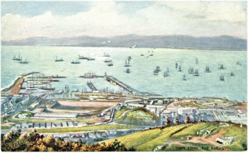
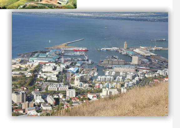
Cape Town Harbour
The history of the port follows that of Cape Town, which traces its roots back to 6 April 1652 when Jan van Riebeeck of the Dutch East India Company (VOC) established a revictualing station there. Earlier explorers had called it Table Bay from the late 15th century onwards.
A vicious storm in 1858, long after the demise of the VOC, saw 30 ships blown ashore and wrecked, with huge loss of life. Lloyd's of London declined all further insurance on ships in Table Bay in winter, resulting in the British Colonial Government starting the construction, in 1860, of the first breakwater. This developed into the Victoria and Alfred Basin, created the first safe harbour. There has been extensive expansion since then
Click an icon below to navigate to:-
Proudly powered by Weebly
